
FAA: Data from U-2 spy plane caused computer issue
 // 6/5/14 // 10 hours ago
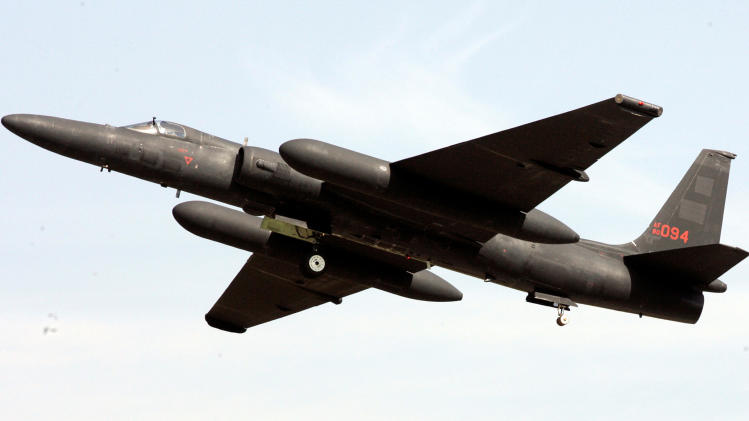 |
| U.S. U2 reconnaissance plane |
.
Defense cuts now threaten to knock the
high-flying reconnaissance aircraft nicknamed the Dragon Lady out of the
sky. The Air Force wants to gradually retire the fleet of 32 planes
that can soar to an altitude of 70,000 feet, collect intelligence on
North Korea and Russia and rapidly send the data to U.S. commanders, a
crucial capability with an unpredictable Kim Jong Un in Pyongyang and an
emboldened Vladimir Putin in Moscow. (AP Photo/ Lee Jin-man, File)
LOS ANGELES (AP) — The
primary air traffic control system around Los Angeles shut down last
week because data from the a U-2 spy plane's flight plan confused
software that helps track and route aircraft around the region, the
Federal Aviation Administration said Monday.
The problem had nothing to do with spy-related signals sent by the Cold War-era plane.
.
The
plane flies at around 60,000 feet under "visual flight rules."
According to the FAA, a computer perceived a conflict between the
altitude and the use of visual flight rules, and began trying to route
the plane to 10,000 feet. The number of adjustments that would need to
be made to routes of other planes throughout the area overwhelmed the
software.
"The extensive
number of routings that would have been required to deconflict the
aircraft with lower-altitude flights used a large amount of available
memory and interrupted the computer's other flight-processing
functions," the FAA said in a statement.
.
The
Pentagon confirmed Monday that an Air Force U-2 spy plane was
conducting training operations in the area. It is not unusual for a U-2
to operate in the region, and the necessary flight plan had been
submitted for the high-flying plane, Col. Steve Warren said.
The connection between the U-2 and the outage was first reported by NBC News.
.
Since
the incident, the FAA has been analyzing what went wrong with its En
Route Automation Modernization system. The computer system, known as
ERAM, allows air traffic controllers at several dozen "en route centers"
around the country to identify and direct planes at high altitudes.
.
The
Los Angeles en route center controls high altitude air traffic over
southern and central California, southern Nevada, southwestern Utah and
western Arizona — except airspace designated for military use.
.
In its statement, the FAA said it has adjusted ERAM to require altitude details for flight plans.
"The
FAA is confident these steps will prevent a reoccurrence of this
specific problem and other potential similar issues going forward," the
agency said.
.
When the system
failed, air traffic controllers in Southern California had to call their
counterparts at neighboring centers to update them on each plane's
flight plan, according to Nate Pair, the president for Los Angeles
Center of the National Air Traffic Controllers Association. While that
was more onerous than normal operations — when computers automatically
pass along updates — the system still worked, Pair said.
No comments:
Post a Comment