The Hellenic Navy (HN) (Greek: Πολεμικό Ναυτικό, Polemikó Naftikó, abbreviated ΠΝ) is the naval force of Greece, part of the Greek Armed Forces. The modern Greek navy has its roots in the naval forces of various Aegean Islands, which fought in the Greek War of Independence. During the periods of monarchy (1833–1924 and 1936–1973) it was known as the Royal Navy (Βασιλικόν Ναυτικόν, Vasilikón Naftikón, abbreviated ΒΝ).The total displacement of all the navy's vessels is approximately 150,000 tons.The motto of the Hellenic Navy is "Μέγα το της Θαλάσσης Κράτος" from Thucydides' account of Pericles' oration on the eve of the Peloponnesian War. This has been roughly translated as "Great is the country that controls the sea". The Hellenic Navy's emblem consists of an anchor in front of a crossed Christian cross and trident, with the cross symbolizing Greek Orthodoxy, and the trident symbolizing Poseidon, the god of the sea in Greek mythology. Pericles' words are written across the top of the emblem. "The navy, as it represents a necessary weapon for Greece, should only be created for war and aim to victory."...............The Hellenic Merchant Marine refers to the Merchant Marine of Greece, engaged in commerce and transportation of goods and services universally. It consists of the merchant vessels owned by Greek civilians, flying either the Greek flag or a flag of convenience. Greece is a maritime nation by tradition, as shipping is arguably the oldest form of occupation of the Greeks and a key element of Greek economic activity since the ancient times. Nowadays, Greece has the largest merchant fleet in the world, which is the second largest contributor to the national economy after tourism and forms the backbone of world shipping. The Greek fleet flies a variety of flags, however some Greek shipowners gradually return to Greece following the changes to the legislative framework governing their operations and the improvement of infrastructure.Blogger Tips and Tricks
This is a bilingual blog in English and / or Greek and you can translate any post to any language by pressing on the appropriate flag....Note that there is provided below a scrolling text with the 30 recent posts...Αυτό είναι ένα δίγλωσσο blog στα Αγγλικά η/και στα Ελληνικά και μπορείτε να μεταφράσετε οποιοδήποτε ποστ σε οποιαδήποτε γλώσσα κάνοντας κλικ στη σχετική σημαία. Σημειωτέον ότι παρακάτω παρέχεται και ένα κινούμενο κείμενο με τα 30 πρόσφατα ποστς....This is a bilingual blog in English and / or Greek and you can translate any post to any language by pressing on the appropriate flag....Note that there is provided below a scrolling text with the 30 recent posts...Αυτό είναι ένα δίγλωσσο blog στα Αγγλικά η/και στα Ελληνικά και μπορείτε να μεταφράσετε οποιοδήποτε ποστ σε οποιαδήποτε γλώσσα κάνοντας κλικ στη σχετική σημαία. Σημειωτέον ότι παρακάτω παρέχεται και ένα κινούμενο κείμενο με τα 30 πρόσφατα ποστς.........

Wednesday, August 19, 2009

Hurricane "Bill" in Atlantic [ 358 ]

Earth Observatory

Hurricane Bill in First Full Disk Thermal Image from Newest Weather Satellite

Posted August 19, 2009
Hurricane Bill in First Full Disk Thermal Image from Newest Weather Satellite
download large image (1 MB, JPEG) acquired August 17, 2009

Remote-sensing scientists call a satellite image that captures an entire hemisphere of the Earth in one view a “full-disk” image. The delivery of the first full-disk image from a newly launched weather satellite is an exciting milestone in the mission. It provides scientists and engineers with incontrovertible evidence that a new satellite—as well as the communications systems needed to deliver the images back to Earth—is ready to do its job.

On August 17, 2009, at 1:31 p.m. EST, the latest NASA/NOAA geostationary weather satellite, called GOES-14, returned its first full-disk thermal infrared (IR) image, showing radiation with a wavelength of 10.7 micrometers emanating from Earth. Infrared images are useful because they provide information about temperatures. A wavelength of 10.7 micrometers is 15 times longer than the longest wavelength of light (red) that people can see, but scientists can turn the data into a picture by having a computer display cold temperatures as bright white and hot temperatures as black. The hottest (blackest) features in the scene are land surfaces; the coldest (whitest) features in the scene are clouds.

In the heat of the midday sun, the exposed rock in sparsely vegetated mountain ranges and high-altitude deserts in western North and South America are dark. In North America, the temperatures cool (fade to lighter gray) along a gradient from west to east, as the semi-deserts of the West and Southwest transition to the grasslands and croplands of the Great Plains, which transition to forests in the East.

A band of scattered storms across the equatorial Pacific shows the location of the Intertropical Convergence Zone, which is a belt of showers and thunderstorms that persists near the equator year round. Need help precisely locating the equator? Look for the dark (hot) spots in the Pacific Ocean west of South America: those are the Galapagos Islands, and the equator passes through the northern tip of the largest island.

Perhaps the most significant features related to U.S. weather appear in the upper right quadrant of the disk: the remnants of Tropical Storm Claudette drenching the eastern Gulf Coast, Tropical Depression Ana unwinding over Puerto Rico and the Dominican Republic, and Hurricane Bill approaching from the central Atlantic.

The GOES satellites have three levels of naming. The two operational satellites are always called GOES-East (view centered at 75 degrees West) and GOES-West (view centered at 135 degrees West.) Replacements for the on-duty satellites are designated by a letter during their development and launch phases. When they are safely in orbit, they receive a number. Two backups are stored on orbit and are activated when the on-duty satellites fail.

NASA: Aqua’s satellite orbit...[ 357 ]

Earth Observatory

Flying Steady: Mission Control Tunes Up Aqua’s Orbit

By Holli Riebeek. Design by Robert Simmon. August 18, 2009

Set into orbit to monitor Earth’s atmosphere and water systems, NASA’s Aqua satellite must maintain a very precise orbit. Gravity pulls at the satellite, gradually changing the angle of its orbit and making it necessary for engineers in mission control to correct the orbit. This article follows events during a recent orbital adjustment maneuver.

April 23, 2009, 15:12:00 UTC: NASA’s Aqua satellite comes around the limb of the Earth into the view of an orbiting Tracking and Data Relay Satellite in position to connect Aqua with its controllers on the ground. The Earth beneath Aqua is dark, except perhaps for moonlight reflecting off clouds over the icy North Pacific Ocean.

Rendering of the Aqua satellite as it orbits over the nighttime North Pacific.
NASA’s Aqua satellite orbits 705 kilometers (440 miles) above the Earth, carrying six instruments that monitor Earth’s atmosphere and water systems. (NASA image by Reto Stöckli.)

In Aqua’s Mission Control Center at NASA Goddard Space Flight Center in Greenbelt, Maryland, it is 11:12 in the morning on a sunny, cool spring day. A group of engineers have gathered in two adjoining control rooms. Each sits at a computer station tracking the satellite’s position and status in dark-colored charts and lines of computer code. Above them, blue neon numbers flash a countdown: 40 minutes until loss of signal. In 40 minutes, the satellite moves out of view of either the data relay satellite or a ground station. In that time, they have to turn the satellite approximately 90 degrees, fire the thrusters to alter its orbit, and then turn the satellite to face forward again, ready to collect data. They’ve been planning this move for more than a year.

Photograph of John Nidhiry in the Aqua mission control room, NASA GSFC.Photograph of the clock in the Aqua mission control room, NASA GSFC.
John Nidhiry (foreground) tracks Aqua’s motion during the orbital maneuver while Scott Blanchard reaches for the SCAMA (black telephone) as he notes the time on the countdown clock above him. (Photographs courtesy William Hrybyk, NASA GSFC.)

15:15:14 UTC: Aqua’s onboard computer detects that the satellite is pointing the wrong direction. It should correct this error by turning 86.466 degrees to the right. It fires its four thrusters to initiate the turn.

The error is a fiction, sent to the computer earlier to get the satellite to turn itself around, or “slew out” in engineer speak. In Mission Control, guidance, navigation, and control engineers Scott Blanchard and John Nidhiry watch the data flowing down from the satellite, tracking to see if the satellite will follow the commands they had previously sent to it. Blanchard lifts a blocky phone (the “SCAMA,” or station conferencing and monitoring arrangement):”Initiating slew out.” His voice carries over the SCAMA to identical devices at each station in the room or anywhere else in the world where team members might be gathered. A few feet away, flight systems manager James Pawloski responds into the intercom system: “Copy, flight.” 36 minutes and 46 seconds are left.

Photograph of the Aqau control room, NASA GSFC.
Engineers track the progress of Aqua’s orbital maneuver from the mission control room at NASA’s Goddard Space Flight Center. (Photograph courtesy William Hrybyk, NASA GSFC.)

If things go according to plan, the turn should take 9 minutes and 55 seconds. The turn is necessary because the flight team plans to shift Aqua’s orbit closer to the pole by a hundredth of a degree to maintain the strict orbit required for precise science measurements of Earth’s oceans and water cycle.

On the daytime side of the Earth, Aqua orbits from south to north (called an ascending polar orbit), not passing directly over either pole, but coming close to each. Crossing near the North Pole onto the nighttime side of Earth, the satellite moves south again to the South Pole. As the satellite circles, the Earth spins underneath it, so that on each orbit, Aqua is over a different place on Earth. In a single day, the widest-viewing sensor on the satellite will cover most of the Earth’s surface.

The Aqua satellite's global observations.
Aqua’s view of Earth on March 16, 2009. The gray stripes are gaps in the satellite’s field of view between each orbit. The “pole hole” over the Arctic is the area where there is not enough daylight at that time of year to make a visible (photo-like) image. (NASA image courtesy MODIS Rapid Response Team.)

Aqua is a scientific research satellite, set into to orbit to provide information about Earth’s water systems—both in the atmosphere and on the surface. Such measurements are crucial in understanding the climate system. If they are to be used to study climate change, the measurements must be consistent over time so that scientists can make valid comparisons. That means that each measurement needs to be taken at about the same time of day to ensure that the angle of the sunlight falling on the ocean, atmosphere, or land and reflecting back to the satellite is as consistent as possible.

To achieve this consistency, Aqua is in a polar orbit that takes it over the equator between 1:30 and 1:45 p.m. local time on every daytime orbit. The satellite crosses the poles at a very precise location, and then circles around the nighttime side of the Earth, moving over the equator between 1:30 and 1:45 a.m. local time. This type of special polar orbit is called a frozen Sun-synchronous orbit.

It takes work to maintain a frozen Sun-synchronous orbit. Tugged by the Sun and Moon, polar-orbiting satellites gradually drift from a north-south orbit to an orbit that leans east-west. Eventually, Aqua’s orbit will shift enough that it no longer follows the afternoon sunlight around the globe. To compensate for gravity’s pull, Aqua’s controllers have to shift the satellite’s orbit toward the pole (right relative to its forward motion at night) every couple of years. Since the thrusters are on the back of the spacecraft, the satellite has to turn to face right so that when the thrusters fire, the satellite moves right.

15:16:00 UTC: Aqua’s instruments begin to notice that Earth is not where it should be and that the satellite’s motion is off. The satellite sends a distress signal to Mission Control.

“Red alarms,” one of the online engineers in contact with the satellite reports over the SCAMA. In the adjoining room, red and yellow grids flash across one of Pawloski’s computer screens. He is expecting the alarms: they mean that the instruments are correctly reporting that the satellite is turning. “Ignore red alarms.” A little more than 35 minutes are left.

Photograph of James Palowski in the Aqua control room, NASA GSFC.
Flight Systems Manager James Pawloski oversees Aqua’s maneuver from the mission control center at Goddard Space Flight Center. (Photograph courtesy William Hrybyk, NASA GSFC.)

If the satellite does not turn quickly enough, Pawloski will abort the maneuver. There has to be time to complete the burn that will shift the orbit and then turn the satellite back around before Aqua crosses into the daytime side of the Earth. Some of Aqua’s instruments are sensitive to solar radiation. They are shielded as long as the satellite faces forward, but when the satellite turns, light and other electromagnetic energy can get into the instruments. Since the shields don’t protect the instruments from the Sun while the satellite is turned during the maneuver, the flight team uses the Earth as a shield, turning the satellite while it is on the dark side of the Earth. The entire maneuver has to be finished and the satellite turned to place the shield between the sensors and the Sun before Aqua comes back around into the light.

At the guidance, navigation, and control station, Blanchard and Nidhiry intensely watch the satellite’s movement. “Halfway through slew,” Blanchard reports with 31 minutes and 52 seconds to go. The turn is on schedule. Conversations begin floating around the room while everyone waits for the satellite to finish its turn

Siemens, όλα τα σφάζει και τα μαχαιρώνει?[ 356 ]

KKE: Συκοφαντίες Κοροβέση για την υπόθεση Siemens

NAFTEMPORIKI.GR Τρίτη, 18 Αυγούστου 2009 20:12

«Αλλοπρόσαλλες» χαρακτηρίζει τις δηλώσεις Κοροβέση το ΚΚΕ κατηγορώντας τον πως «οδηγούμενος από τις εσωκομματικές έριδες και αντιπαραθέσεις στον ΣΥΝ/ΣΥΡΙΖΑ και από τη γνωστή εμπάθειά του για το ΚΚΕ, αναμασάει συκοφαντίες για τις οποίες έχουμε δώσει εδώ και καιρό και με τον πιο κατηγορηματικό τρόπο ξεκάθαρες απαντήσεις».

«Μάλλον πρόκειται περί φάρσας, χρήσιμης όμως στη ΝΔ και το ΠΑΣΟΚ και σε όσους θέλουν να θολώσουν τα νερά στην υπόθεση Siemens», υπογραμμίζει σε ανακοίνωσή του το ΚΚΕ.

Η αποστολή Stardust της NASA[ 355 ]

Αμινοξύ από το Διάστημα
Βασικό συστατικό της ζωής ανιχνεύεται σε κομήτη

Reuters
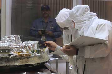
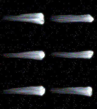
Δείγματα από την ουρά του κομήτη Βιλντ-2 έφτασαν στη Γη με την αποστολή Stardust της NASA
Λος Αντζελες 18-08-09

Ένα από τα 20 αμινοξέα που χρησιμοποιούν ως δομικά συστατικά οι ζωντανοί οργανισμοί της Γης ανιχνεύθηκε για πρώτη φορά σε κομήτη, δίνοντας ώθηση στη θεωρία της πανσπερμίας, σύμφωνα με την οποία οι πρώτες ύλες της ζωής έφτασαν στον πλανήτη από το Διάστημα.

Το απλό αμινοξύ γλυκίνη ανιχνεύθηκε σε απειροελάχιστες ποσότητες σε δείγματα από την ουρά του κομήτη Βιλντ-2, τον οποίο πλησίασε το σκάφος Stardust της NASA τον Ιανουάριο του 2004.

Τα δείγματα έπεσαν με αλεξίπτωτο στην έρημο της Γιούτα το 2006.

«Αυτή είναι η πρώτη φορά που βρίσκουμε ένα αμινοξύ σε κομήτη» δήλωσε η αστροβιολόγος Τζέιμι Ελίσα, επικεφαλής της ερευνητικής ομάδας στο Κέντρο Διαστημικής Πτήσης Goddard της NASA στο Μέριλαντ. «Η ανακάλυψή μας συνηγορεί στη θεωρία ότι ορισμένα από τα συστατικά της ζωής σχηματίστηκαν στο Διάστημα και έφτασαν στη Γη πριν από πολύ καιρό με τις προσκρούσεις μετεωριτών και κομητών» εκτιμά.

Όπως αναφέρει το Reuters, η έρευνα έχει γίνει δεκτή προς δημοσίευση στην επιθεώρηση Meteoritics and Planetary Science.

Οι ερευνητές ανίχνευσαν τη γλυκίνη στις πρώτες, προκαταρκτικές αναλύσεις, έπρεπε όμως να βεβαιωθούν ότι δεν επρόκειτο για μόλυνση των δειγμάτων από γήινους οργανισμούς. Η εξωγήινη προέλευση του αμινοξέος επιβεβαιώθηκε αργότερα από την παρουσία ασυνήθιστα υψηλών συγκεντρώσεων άνθρακα-13.

Γλυκίνη και άλλα αμινοξέα δεν είχαν εντοπιστεί μέχρι σήμερα σε κομήτες, είχαν όμως ανακαλυφθεί σε αρκετούς μετεωρίτες που έχουν πέσει στη Γη.

Τα 20 βασικά αμινοξέα που απαντώνται σε όλους τους οργανισμούς της Γης ενώνονται μεταξύ τους στη σειρά και σχηματίζουν όλες τις πρωτεΐνες.

Newsroom ΔΟΛ


«Δημοκρατία της Βόρειας Μακεδονίας» ? [ 354 ]

Σύνθετη ονομασία έναντι όλων

κλικ και διαβασε την ελληνική απάντηση στην τροποιημένη πρόταση Νίμιτς

«Όχι» από την Αθήνα στην τελευταία πρόταση Νίμιτις για την ονομασία της ΠΓΔΜ

Αθήνα - Τρίτη 18 Αυγούστου 2009 [ 23:14 ]

«Βόρεια Μακεδονία» υπό όρους θέλουν τα Σκόπια

Εντός της εβδομάδος αναμένεται ο εκπρόσωπος της πΓΔΜ στη διαπραγματευτική διαδικασία για το θέμα της ονομασίας να υποβάλει στον μεσολαβητή του ΟΗΕ κ. Μάθιου Νίμιτς τις παρατηρήσεις του επί των τροποποιημένων ιδεών που παρουσίασε ο μεσολαβητής και στα δύο μέρη στις αρχές Ιουλίου. Μεταξύ άλλων ο κ. Νίμιτς προτείνει την ονομασία «Δημοκρατία της Βόρειας Μακεδονίας» για διεθνή χρήση.

Ενδιαφέρον ωστόσο παρουσιάζει πρωτοσέλιδο δημοσίευμα της εφημερίδας των Σκοπίων «Ουτρίνσκι Βέσνικ» στο οποίο αναφέρεται ότι τα Σκόπια θα μπορούσαν να αποδεχθούν ως βάση περαιτέρω διαπραγμάτευσης μια σύνθετη ονομασία στην οποία ο γεωγραφικός προσδιορισμός «βόρεια» θα προηγείται του ονόματος «Δημοκρατία της Μακεδονίας» ή θα τίθεται σε παρένθεση. Υψηλόβαθμη διπλωματική πηγή την οποία επικαλείται η ίδια εφημερίδα φέρεται να είπε ότι για την πΓΔΜ δεν είναι αποδεκτό το όνομα «Δημοκρατία της Βόρειας Μακεδονίας», διότι αυτό ουσιαστικά αλλάζει το όνομα της χώρας, ενώ ακολούθως θα υπάρξουν επιπτώσεις στην εθνική ταυτότητα, στη γλώσσα και στον πολιτισμό της πΓΔΜ.